Free Georgia Brochures

Featured Brochures
Department of Natural Resources Interactive Map
Savannah & Tybee Island Insider's Guide 2024

Browse Brochures

Showing 1 - 8 of 8

Toccoa Falls

Visitor's information about our 186 foot high waterfall.

Sights of Stephens County

A map with descriptions of major attractions in Toccoa-Stephens County.

Downtown Toccoa Historic Plaque Tour

Take a guided tour through Toccoa's historic downtown and discover thirty Historic Plaques honoring downtown's rich history.

Tugaloo Bend Heritage Park Trail Guide

The Hiking Trails of Tugaloo Bend Heritage Park take their names from Cherokee towns and place names along the Tugaloo Corridor and its tributaries.

Visitor Walking Guide Historic Downtown Toccoa

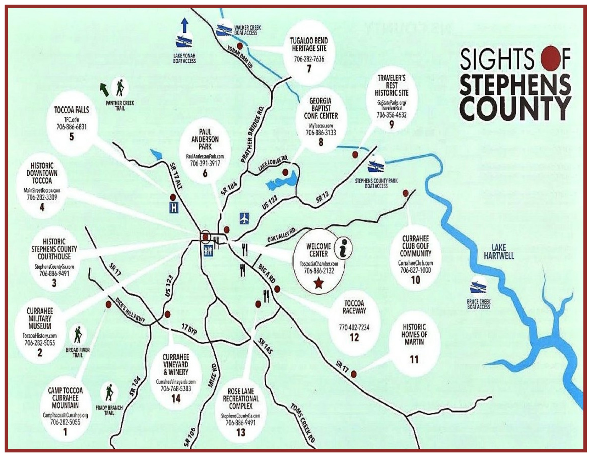
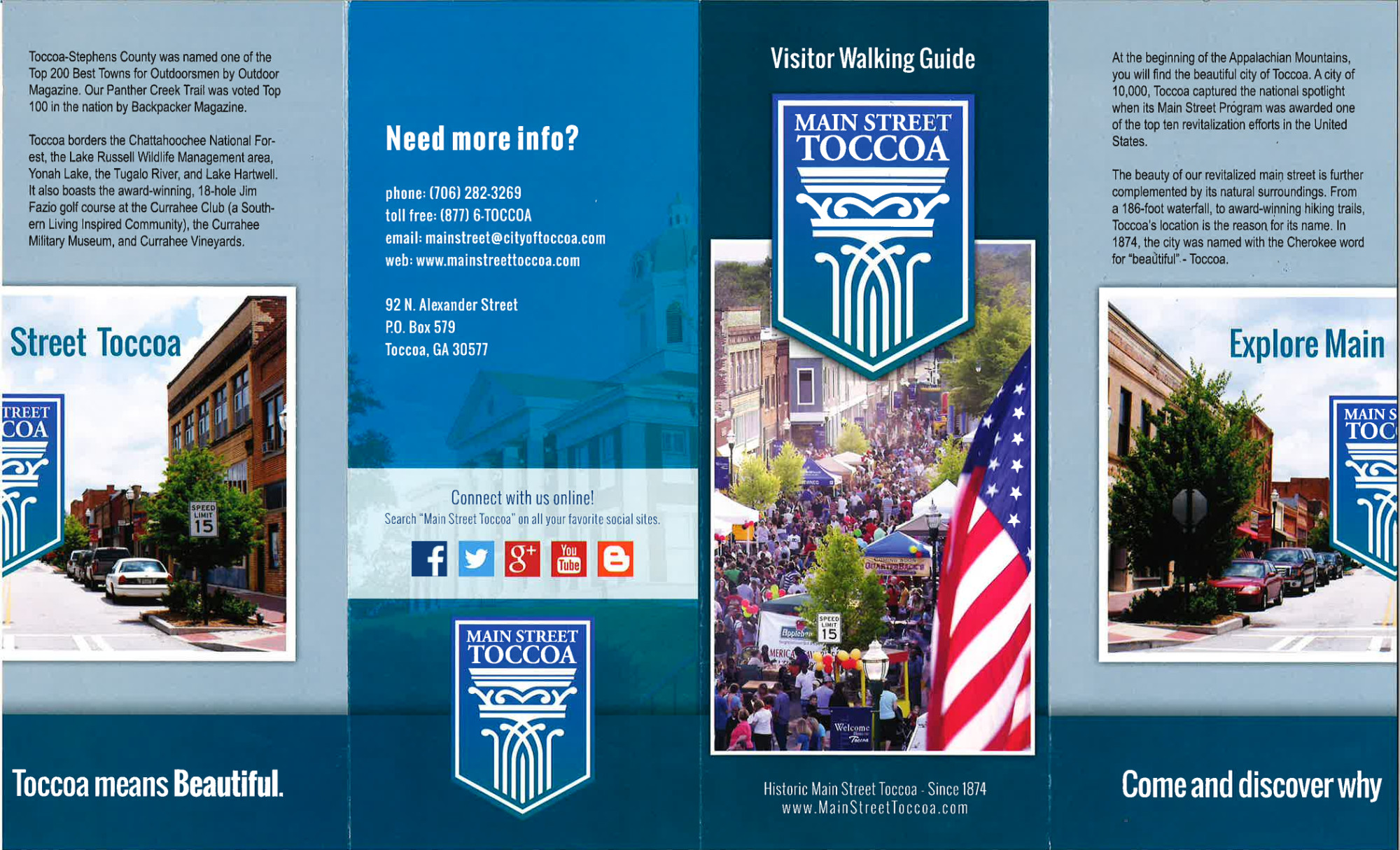
The beauty of our revitalized main street is further complemented by its natural surroundings. From a 186' waterfall, to award winning hiking trails, Toccoa's location is the reason for its name.

Tugaloo Corridor Kayak Tour

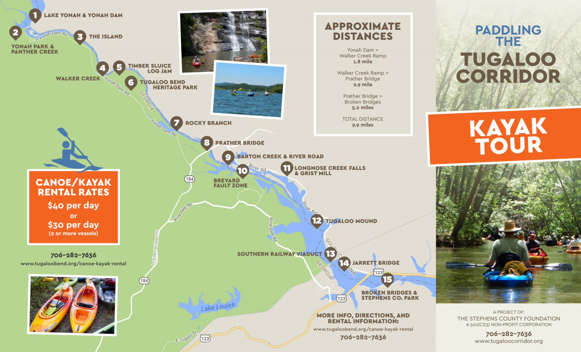
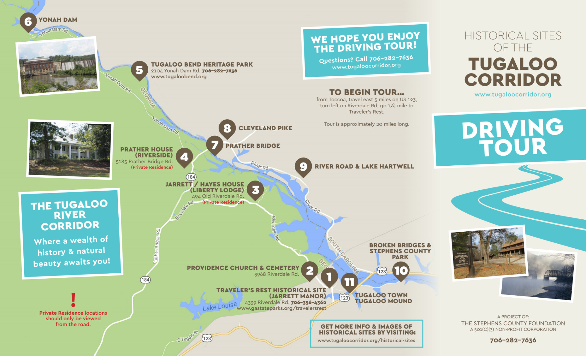
The Tugaloo Corridor comprises the only remaining untamed portion of the Tugaloo River, extending ten miles from Panther Creek and the Yonah Dam area south to Broken Bridges at Hwy 123.

Tugaloo Corridor Driving Tour

The Tugaloo River forms the border between Stephens County Georgia and Oconee County South Carolina from Yonah Dam to the north into the upper reaches of Lake Hartwell on its southern end, a distance of approximately 10 miles.

Scroll To Top